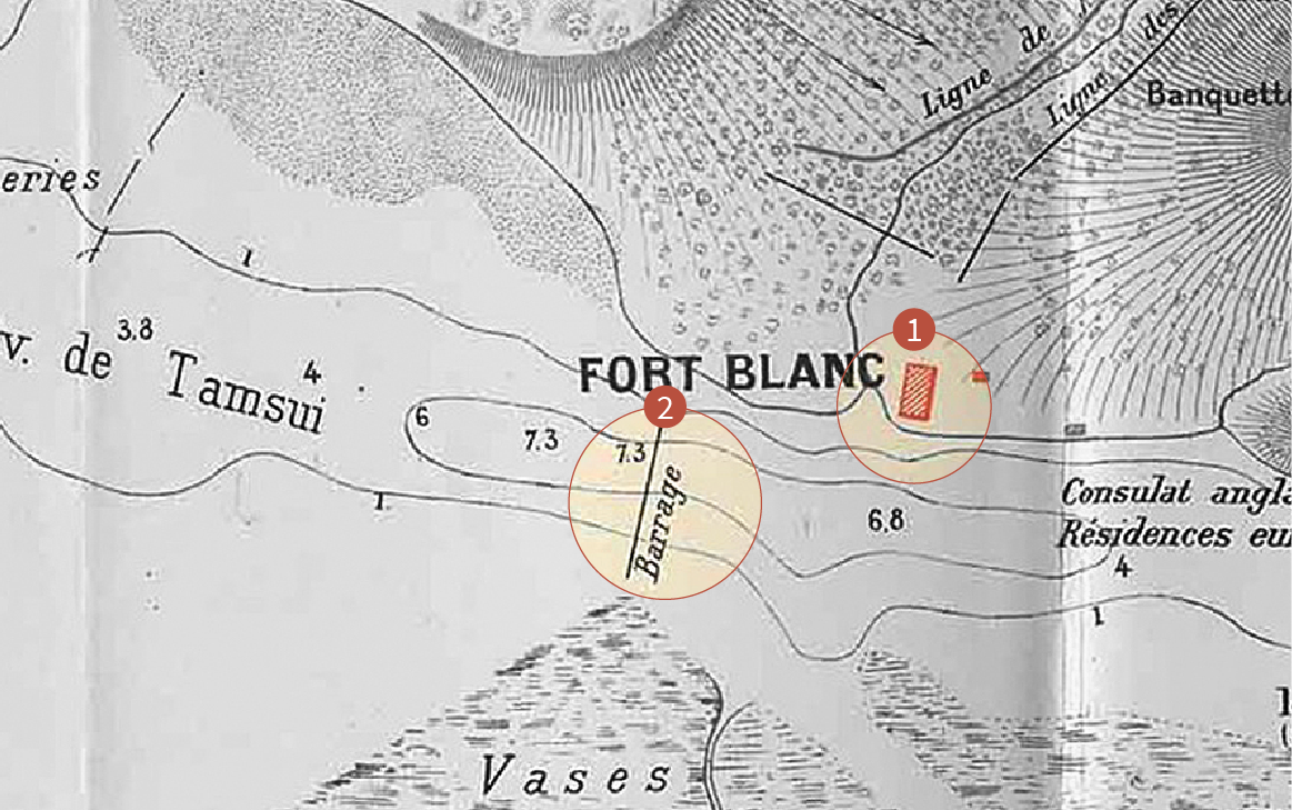
 紅色方塊,Fort Blanc(白砲台);Blockade(阻絕線)
白砲台遺址(附阻絕線) Former Site of Fort Blanc (and Blockade)
位於金目港仔溪口南側,約在今海巡署位置。原係道光年間鴉片戰爭時為防範英艦所築之砲台,因年久失修,到了同治年間滬尾開港後,已淪為輪船進港之指標而被稱做白堡(White Frot)。1884年秋,法艦犯臺時,清軍於其前方堆置沙包,並安裝一門克魯伯大砲,予以改善補強。是年10月2日早上,清法雙方展開砲戰,白砲台因位置太過暴露,目標明顯,不久即遭法艦炮彈摧毀。
當時清軍派兵駐守白砲台附近,負責監看阻絕線,一有敵艦靠近,立即通報水雷營,引爆水雷。阻絕線在淡水河口最窄處,從八里挖子尾到今海巡署附近。將載著石塊的戎克船鑿沉河底,構成一道人工的阻絕線,並在阻絕線後方部署十枚水雷,以防止法艦進入。(文:張建隆)
Located on the south bank of Jinmuzi River mouth around where the Coast Guard Administration is today. First built in the Daoguang era to defend against British attacks during the Opium War, it was allowed to fall into ruin. When Hobe (Tamsui) was opened up to foreign trade during the Tongzih Era, it had become the navigation marker called the White Fort by ships entering the harbor. When French warships attacked Taiwan in the fall of 1884, the Qing forces reinforced the battery with sandbags and installed a Krupp cannon. On the morning of October 2, an artillery duel commenced between the Qing and the French. Fort Blanc’s exposed position meant it was soon destroyed by French bombardment.
Qing troops had been stationed near Fort Blanc to stand guard over the Blockade. If enemy ships were to approach, they would notify the Sea Mine Camp to detonate the sea mines. The Blockade was located at the narrowest point of the Tamsui River mouth. It ran from Wazihwei in Bali to the present-day Coast Guard Administration station. Junks filled with rocks were sunk to create a Blockade. Ten sea mines were also deployed behind the Blockade to keep the French ships at bay. (Text: Chang Jian-Long)